Ohio Department of Transportation
OPPORTUNITY CORRIDOR:
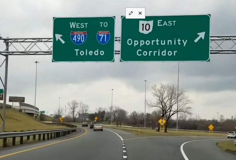
The purpose of the Opportunity Corridor Project is to improve the transportation system and support planned economic development in the areas between I-490/I-77 and University Circle in Cleveland. The area between I-490 and University Circle includes a part of Cleveland known as the “Forgotten Triangle” due to the lack of economic activity. Aside from the transportation benefits it could bring to this part of Cleveland, this effort opens the potential for new economic development, new jobs and a new identity for the community.
An Opportunity Corridor Steering Committee was formed which includes representatives from ODOT, the City of Cleveland, Cuyahoga County, Greater Cleveland Partnership, area Community Development Corporations (CDC), Greater Cleveland Regional Transit Authority, business owners and other local stakeholders. The Steering Committee is staffed by Greater Cleveland Partnership (GCP) and is drafting a community and economic development plan for the corridor project area.
OPPORTUNITY CORRIDOR: Study Goals
In 2004, ODOT retained a consultant team led by HNTB to conduct the Opportunity Corridor Study. ODOT and its engineering consultants at HNTB continue to meet with various partners at the City of Cleveland, GCP and community stakeholders.
There are three primary needs that have been identified by the Opportunity Corridor study:
• Improving system linkage among the roads, neighborhoods, and businesses in the area
• Improving mobility between the Interstate system and University Circle
• Supporting planned economic development
OPPORTUNITY CORRIDOR: Project Overview
In working with local stakeholders and public officials, the purpose of the project was developed. The purpose is to improve the roadway network within a historically underserved, economically depressed area within the City of Cleveland.
The project follows ODOT’s Project Development Process (PDP) for major projects. The 14-step PDP is a project management and transportation decision-making procedure that outlines project development from concept through completion.
During steps 1 through 4, four conceptual alternative solutions were developed and analyzed. The Steering Committee and local stakeholders evaluated the alternatives. It was recommended that only two potential corridors be carried forward for further study.
In March 2010, the project team subdivided the two study area corridors and identified three distinct, geographical sections. The three sections are comprised of the Western section from E. 55th Street to East 75th St.; the Central section identified as E. 75th St. to Quincy Ave; and the Eastern section from Quincy Ave to Chester Ave along E. 105th St. In each geographical section (West, Central and East), three alternatives for each section were identified for further study.
In July 2011, the Steering Committee identified the Recommended Preferred Alternative based on input gathered from the City of Cleveland, CDCs, neighborhood stakeholders and the public.
The Recommended Preferred Alternative would build a boulevard-type road with a wide median and traffic signal. It would also include pedestrian and bicycle paths, tree lawns, landscaping and access to RTA busses and trains. A “No-Build” alternative continues to be evaluated.
OPPORTUNITY CORRIDOR: Next Steps in the Public Involvement Process
Based on public input, the study team continues to evaluate the Recommended Preferred Alternative in more detail as part of the Draft Environmental Impact Statement (DEIS). During the evaluation period, the study team will continue to investigate ways to avoid, minimize, and mitigate possible impacts. The findings of the DEIS will be presented to the public later this year and comments will be sought to develop the final alternative.
OPPORTUNITY CORRIDOR: Community Benefits Area
A development work group comprised of public, private, CDC representatives and neighborhood
stakeholders, facilitated by GCP, have worked together with a local architectural firm, and identified eight to ten potential development sites throughout the community benefit area of the project for future re-use. To date, two of the development districts have preliminary master land use plans. The conceptual roadway plans will be reviewed with each of the CDC partners for feedback to determine that the effort is moving in the right direction and remains consistent with the community’s overall master plan and the City of Cleveland proposed land use plan.
OPPORTUNITY CORRIDOR: Cost
In April 2013, the Federal Highway Administration coordinated a project Cost Estimate Review. Based
on this review, the total cost of the project is estimated to be $331.3 million. The project estimates consider all currently known work required to build the project including the costs of final design, project administration and management, land acquisition, utility relocation, implementation of environmental commitments and mitigation measures, and construction activities.
OPPORTUNITY CORRIDOR: Project Challenges
• Residential and Commercial property impacts (includes individual units in multi-resident
buildings) in an economically depressed area
• Rail issues: proposed corridors run along Norfolk Southern, GCRTA (all three lines) and
CSX tracks
• Funding Detail Design, Right of Way and Construction Phases
• Major Utility Relocation impacts


